The effects of the expansion and intensification of livestock production on the large and meso-mammal community in the Dry Chaco of Paraguay
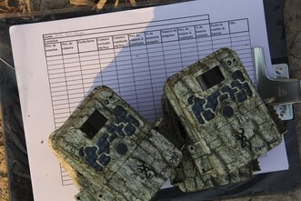
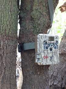
The Dry Chaco of western Paraguay is undergoing some of the highest rates of deforestation in the world mostly due to rapidly expanding livestock production. This two-year project employed 335 double camera trap stations to sample the mammalian community along a gradient of deforestation intensity in the Paraguayan Dry Chaco, taking ~4 million photographs over ~60,000 trap nights. We estimated jaguar (Panthera onca) densities between 0.44 - 1.6 individuals/100 km sq. using spatial capture-recaptue modeling, and are similarly estimating ocelot (Leopardus pardalis) densities. Additionally, we are estimating community-level and single species occupancy using hierarchical models of community occupancy and inter-specific spatio-temporal interactions as a function of environmental and anthropogenic drivers.
In our publication on this research, Jaguar (Panthera onca) population density and landscape connectivity in a deforestation hotspot: The Paraguayan Dry Chaco as a case study, aside from estimating densities in relation to forest conversion, we simultaneously estimated landscape connectivity for jaguars as a function of forest cover based upon our camera trapping data.
In our publication on this research, Jaguar (Panthera onca) population density and landscape connectivity in a deforestation hotspot: The Paraguayan Dry Chaco as a case study, aside from estimating densities in relation to forest conversion, we simultaneously estimated landscape connectivity for jaguars as a function of forest cover based upon our camera trapping data.
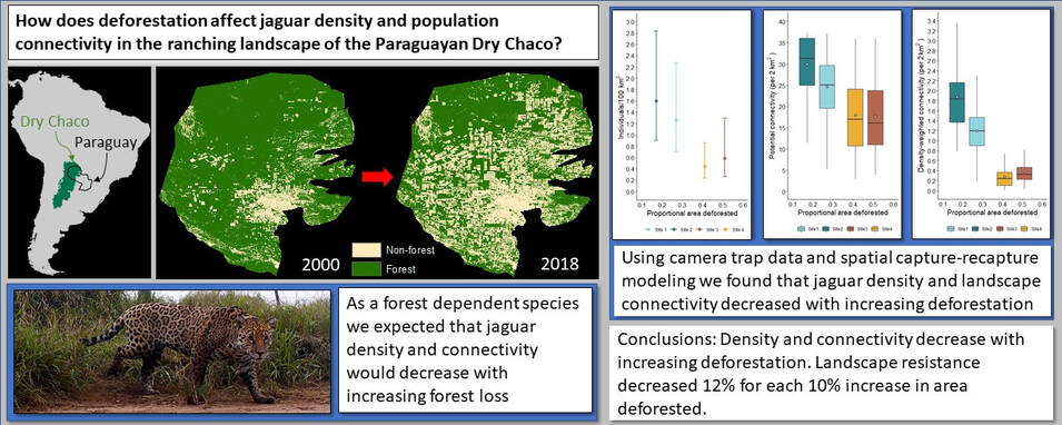
Grapical abstract from our publication in Perspectives in Ecology and Conservation; Jaguar (Panthera onca) population density and landscape connectivity in a deforestation hotspot: The Paraguayan Dry Chaco as a case study
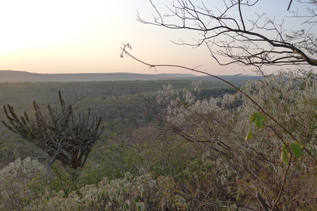
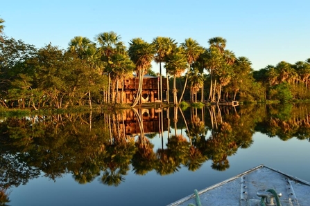
Cerro León, Defensores del Chaco National Park.
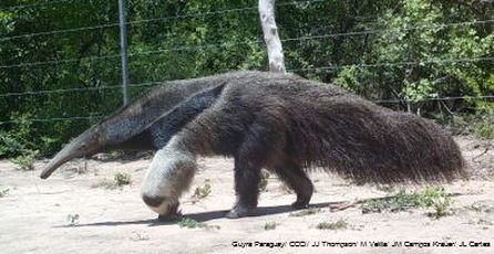
Giant anteater in the Dry Chaco of Paraguay
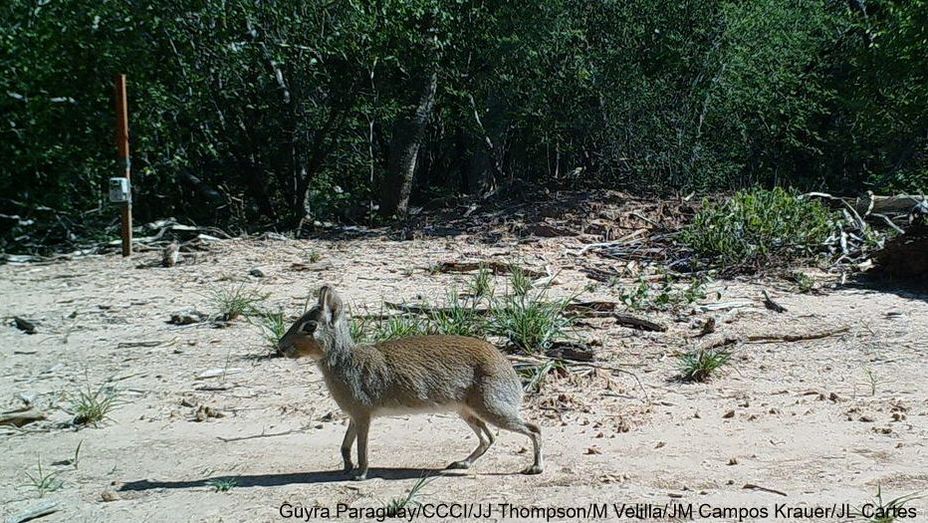
Chacoan mara (Dolichotis salinicola)
|
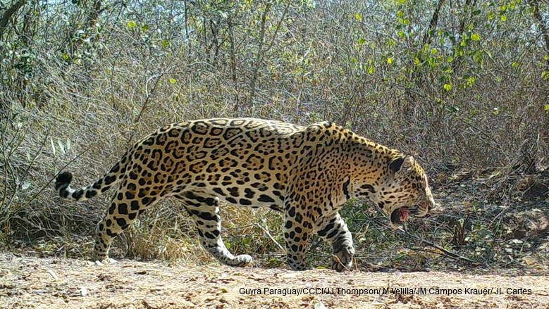
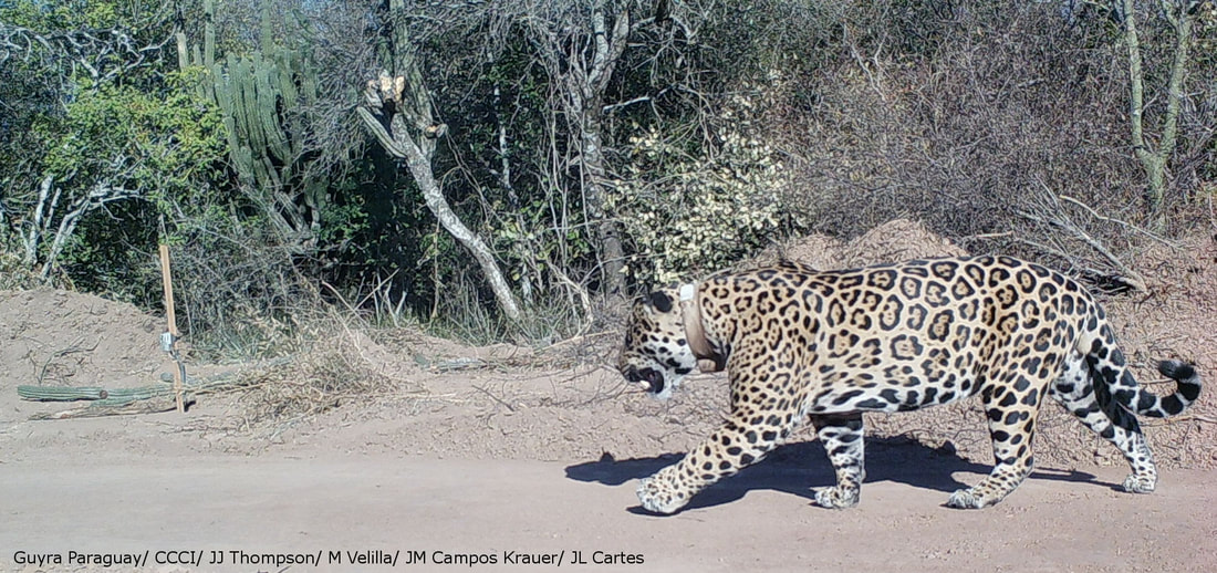
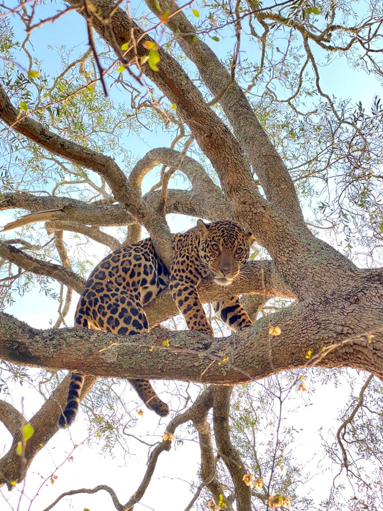
Jaguar in the Paraguayan Dry Chaco.
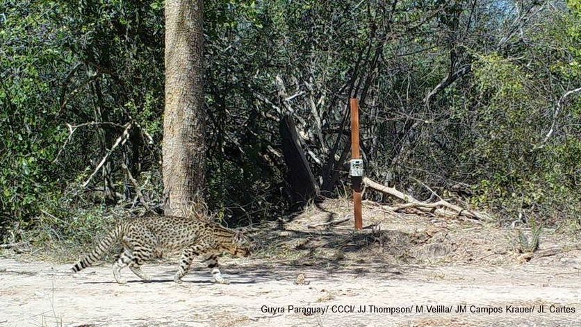
A Geoffroy's cat int the Paraguayan Dry Chaco
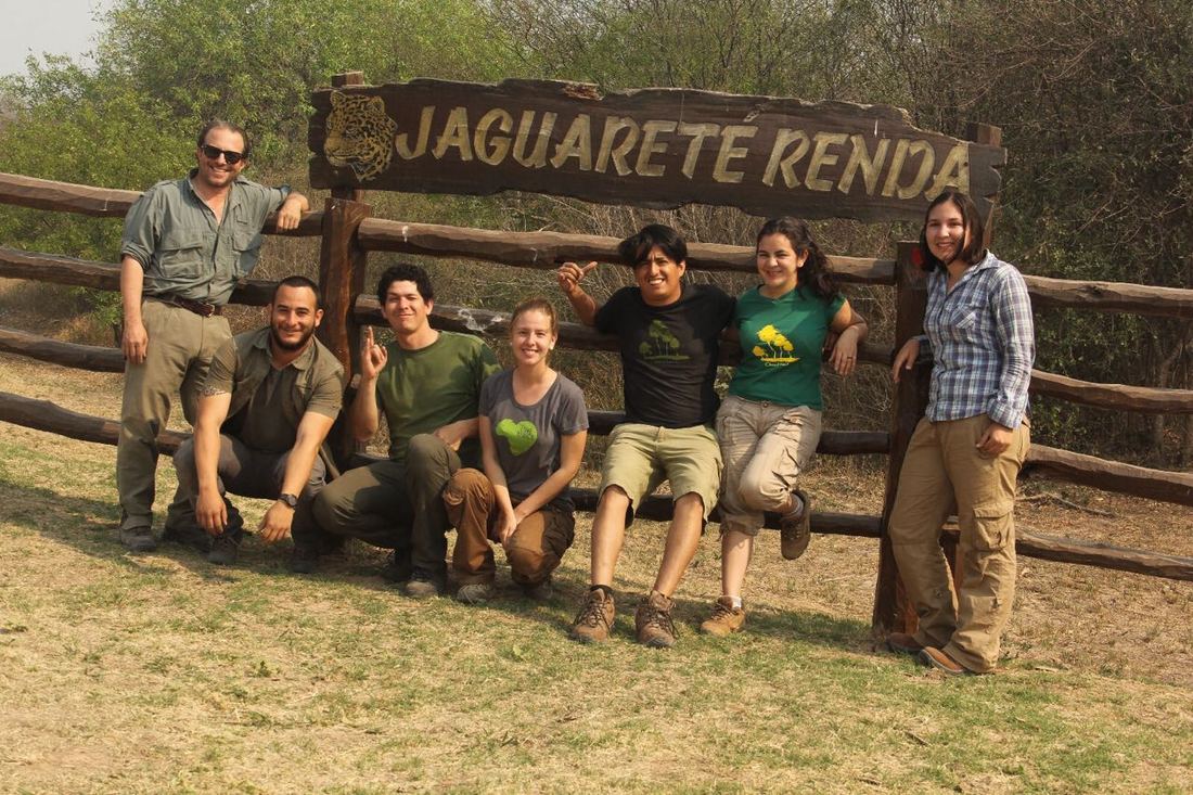
The 2016 field crew
|
Spatial ecology of jaguars (Panthera onca) in Paraguay
A GPS collared male jaguar in the Paraguayan Dry Chaco
|
The rapid and extensive deforestation that has been occurring in western Paraguay has not only resulted in the loss of forest cover, but the fragmentation of the remaining forest. This deforestation, along with persecution and loss of prey species, has led to a contraction in the distribution of jaguar in western Paraguay. Furthermore, only ~7% of the original Atlantic Forest in eastern Paraguay remains with a small isolated remnant population of jaguar remaining in the region. Using GPS-based telemetry data from about 30 jaguars collared since 2002 we analyzed home range size of jaguars in the Pantanal, Atlantic Forest, and Dry and Humid Chaco. Since 2016 my colleagues have been undertaking a telemetry study of jaguars in the Dry Chaco to evaluate potential behavioral differences between jaguars that habitually kill livestock and those that do not.
We have published papers on the spatial ecology of jaguar in western Paraguay and space use by the last remaining jaguars in the Atlantic forest in eastern Paraguay, and a Data Paper in Ecology of jaguar telemetry data from 117 individuals in six countries. Also, along with 59 collaborators, we published the largest analysis of space use of a large carnivore by analyzing telemetry data from 115 jaguars, across 13 ecoregions, and four biomes, finding that spatial needs of jaguars are consistently dependent upon primary productivity, road density, and forest cover through out the species' range. Most recently we contributed to an analysis of the movements of 43 terrestrial mammal species (2300 individuals) in response to Covid-related lockdowns during 2019 that was published in the journal Science. 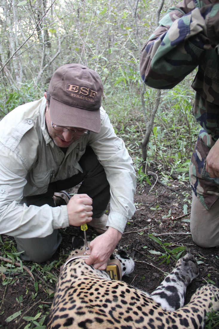
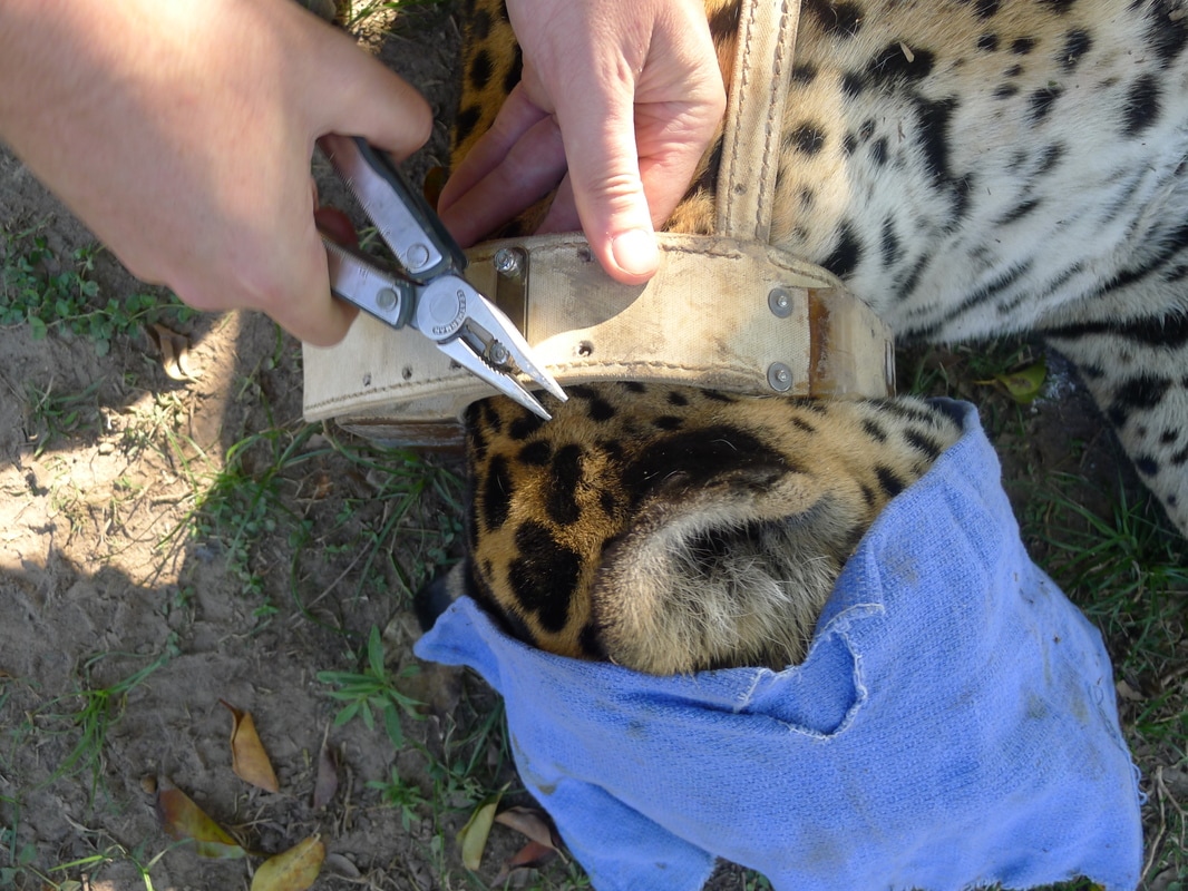
Capture of and affixing GPS collars on jaguars in the Paraguayan Chaco
|
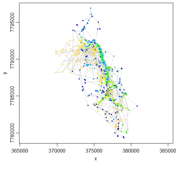
GPS fixes of a collared jaguar in the Paraguayan Pantanal.
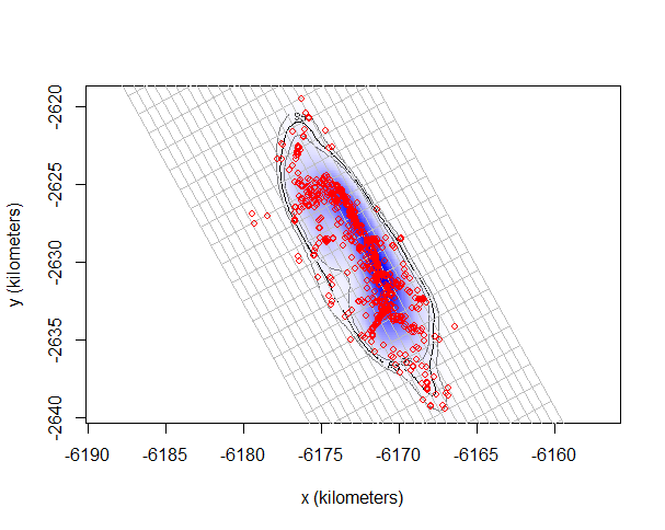
Autocorrelated kernel density estimated (AKDE) home range of a femle jaguar in the Paraguayan Pantanal
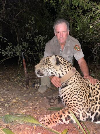
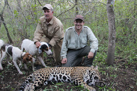
Rocky McBride with a male jaguar in the Paraguayan Chaco prior to release after afixing a GPS satellite collar.
|
The movement ecology of the Marsh deer in the lower delta of the Río Paraná, Argentina
|
The Marsh deer (Blastocerus dichotomus), is the largest deer in South America and is listed as Vulnerable by the IUCN, having been extirpated from the large majority of its distribution. I am collaborating with researchers from Proyecto Pantano to contribute the conservation of the southernmost population of the Marsh deer and its wetland habitats in the lower delta of the Río Paraná through research on space use and movements of the species.
Their is a paucity of information available on the spatial needs and movement behavior of the Marsh deer. The goals of this research are to estimate home range needs, spatial and temporal movement patterns as a function of environmental and human related factors, and preferences in habitat selection. The information generated from this research will be applied towards identifying the year-round habitat needs of Marsh deer for their management within our focal area. 
|
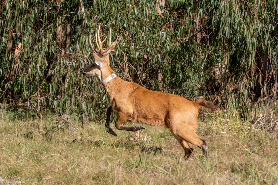
A GPS collared Marsh deer in the lower Río Paraná Delta (Esteban Argerich/Proyecto Pantano).
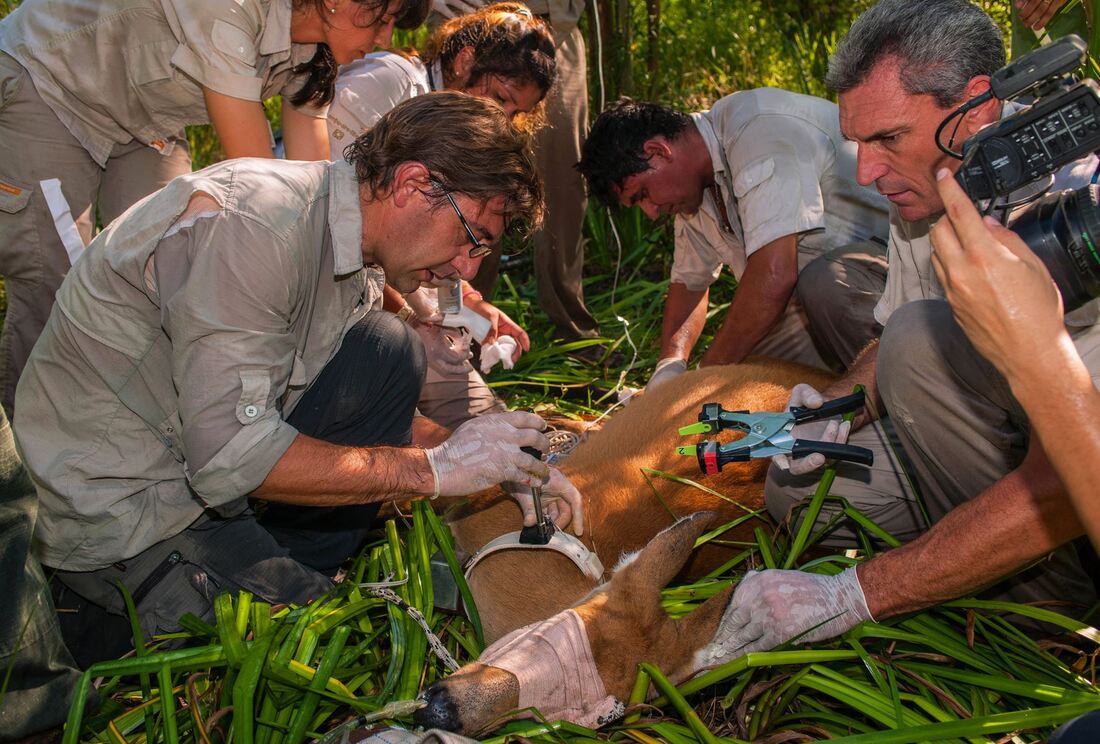
Javier Pereira attaching a GPS collar on a sedated Marsh deer.
|
Development of analytic tools to estimate the composition and diversity of carnivore diet
|
An important topic of interest in the analysis of carnivore diet is determining the necessary sample size to sufficiently estimate dietary composition. This is inherently an issue of incomplete detection and consequently I am developing modeling approaches based upon closed capture-recapture modeling to estimate diet composition of carnivores using a Bayesian modeling framework. An advantageous aspect of my approach is that I can take advantage of fecal DNA to determine the species and sex of individuals which can be incorporated into the modeling to allow for species, sex, and individual specific estimates of diet composition.
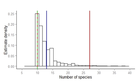
Posterior distribution of estimated species richness in the diet of jaguar in western Paraguay from 41 scats. Blue line represents the estimate (13), green line the observed number of species (10) and red lines the 95% credibility interval (10-27).
|
Jaguar scat, Iguazú National Park, Argentina.
|
Estimating large and meso-mammal occupancy and community composition in the Paraguayan Pantanal
|
The Paraguayan Pantanal represents 5% of the total area of the Pantanal ecosystem and compared to the portions in Brazil and Bolivia the ecology of the Pantanal in Paraguay is little studied. In the initial phase of this project we are sampling the large and meso-mammal community in the Tres Gigantes Reserve, on the border of Paraguay and Bolivia, using remote cameras.
We are employing an occupancy modeling sampling design to estimate species occupancy and community composition in relation to habitat type using hierarchical model of community occupancy in a Bayesian modeling framework. The Tres Gigantes Reserve, as a protected area bordering the Rio Negro National Park of Paraguay and the Otuquis National Park of Bolivia, serves as an excellent site to estimate species occurrence in the Paraguayan Pantanal unaffected from anthropogenic effects typical of the region. Consequently, the data generated here serves as an excellent reference for comparison to nearby areas under cattle production which is the next phase of this project which is a integral component of our project working on resolving feline-livestock conflict in the Paraguayan Pantanal (see the Decision Making page). The subsequent component of this project is to orient our sampling with remote cameras to identify individual jaguars using double camera sites on both the Paraguayan and Bolivian sides of the Rio Negro so that we can estimate jaguar density using a spatial capture-recapture sampling design. |
|

Modeling connectivity and sampling prey availability among jaguar populations
|
Paraguay has, and continues, to undergo some of the highest rates of deforestation in the world. The Atlantic Forest of the eastern half of the country has been mostly cleared during the last 30 years so that only ~7% of the original forest cover of the region remains. The Gran Chaco of the western half of the country since 2000 has witnessed mean annual deforestation rates of ~1500 ha/day stemming from a rapidly growing livestock production sector.
This forest loss has also led to the fragmentation of much of the remaining forest. The extent of how this rapid and extensive forest loss has affected jaguar and its prey species is largely unknown. Consequently, I have undertaken modeling connectivity among Jaguar Conservation Units in Paraguay and those adjacent in Argentina, Bolivia and Brazil using least-cost and circuit theory modeling (Thompson and Velilla 2017). I also was involved with ground truthing jaguar and prey occurrence in connectivity corridors for jaguars and modeling the data from those surveys. This work culminated in a project report and the peer-reviewed publication Anthropogenic factors disproportionately affect the occurrence and potential population connectivity of the Neotropic’s apex predator: The jaguar at the southwestern extent of its distribution. 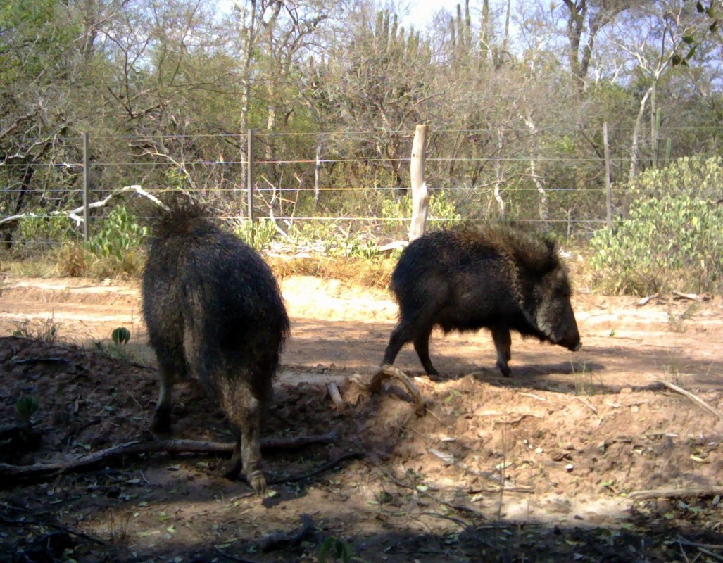
Chacoan peccary (Catagonus wagneri) in the Paraguayan Chaco. Photo:C. Martinéz Marti/Panthera.
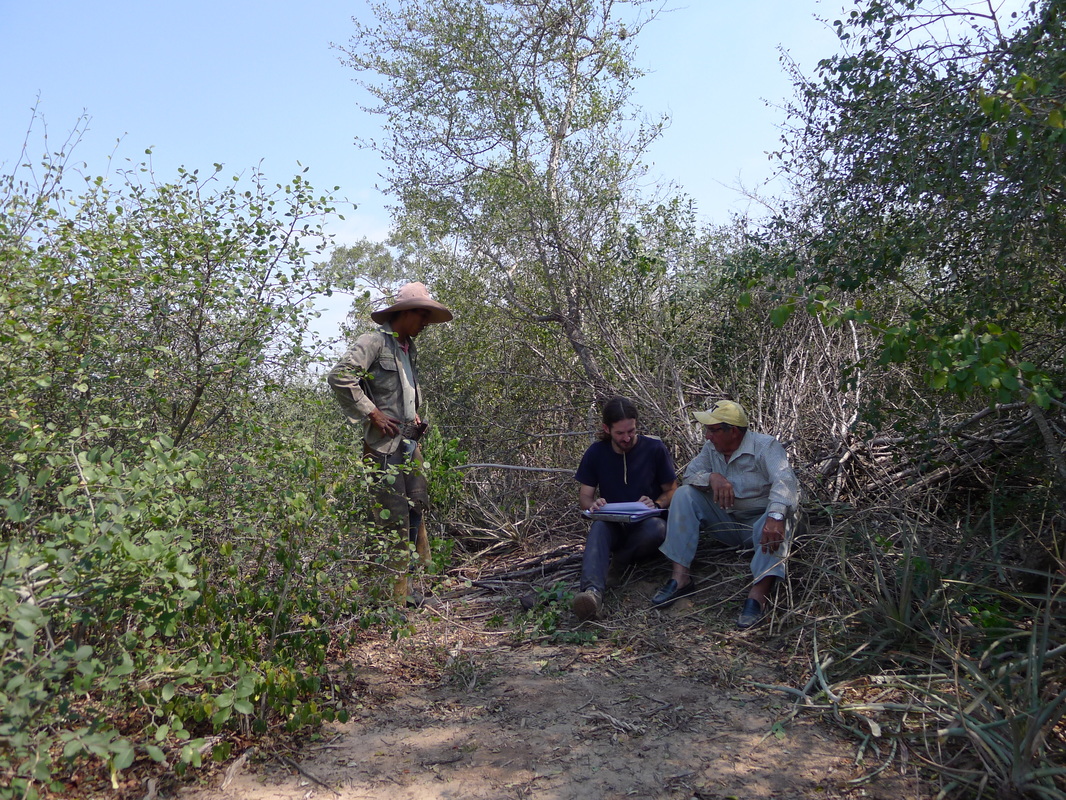
Conducting an interview of a land owner and employee regarding the presence of jaguar and prey species.
|
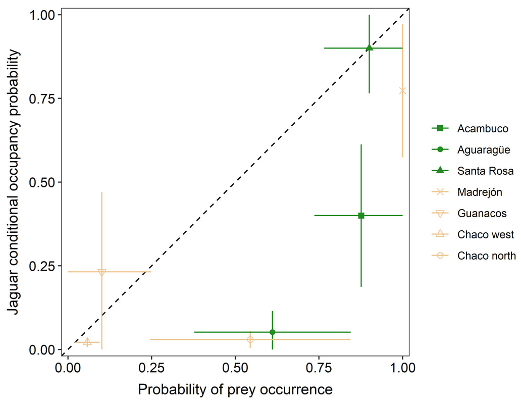
Means and 95% confidence intervals of jaguar conditional occupancy versus probability of four of six of species occurring in study areas. Dashed linerepresents the 1:1 relationship between the two parameter estimates. (Thompson et al. 2020)
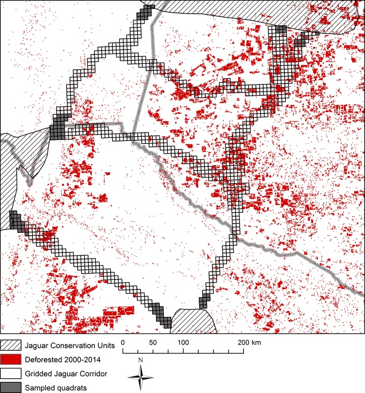
Jaguar Conservation Units and gridded jaguar connectivity corridors in Argentina, Bolivia and Paraguay with deforested areas in the Yungas and Gran Chaco during 2000-2014 overlayed (Data source: Global Forest Watch).
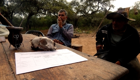
Interviewees in the Argentine Chaco.
|
Gamebird ecology and the interactive effects of agricultural land use and depredation
|
Globally many terrestrial gamebird species are associated with row crop and grazing lands and their populations have been subjected to both negative and positive effects as a function of land management practices. These effects are further exacerbated in relation to the composition and management of predator communities.
In particular, however, since the end of World War II the intensification of crop and grazing systems have had significant negative implications for terrestrial gamebirds worldwide. The cronogram of the process of agricutlural intensification has been different across continents, with North Americ and western Europe undergoing the process starting in the late 1940's, South Africa in the 1980's and austral South America during the 1990's. My research in this area is particularly related to the effects of this intensification on tinamou (Tinamidae) species in austral South America, which largely is driven by extensive land conversion and substitution for soybean production, and placing it in a comparative context with the effects on terrestrial gamebirds observed on other continents. As ground nesting species with precocial young terrestrial gamebirds serve as excellent indicator species of the effects on population parameters stemming, not only direct land use effects, but also from the predator community. Consequently, I am also very interested in using the vital rates of gamebird populations to measure trohpic cascades in relation to predator community composition and management. 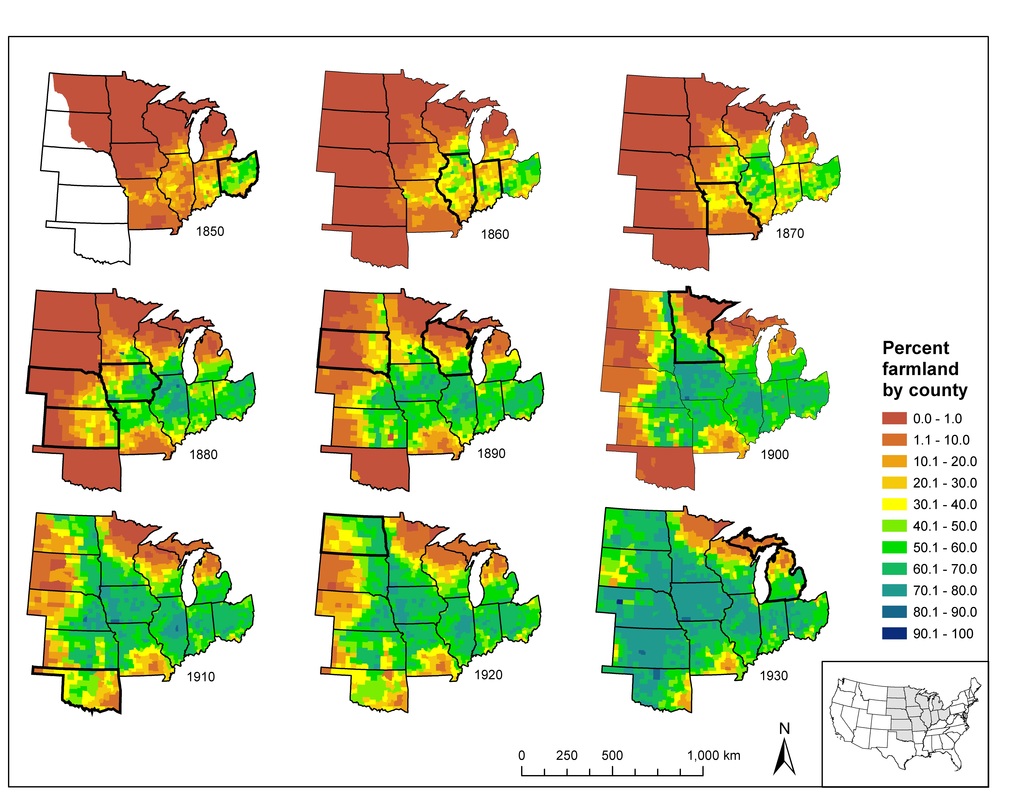
Percent of county area in row crop agriculture in the north-central USA from 1850-1930. Highlighted states correspond to time period for that state when Greater prairie chicken (Tympanuchus cupido) populations were highest (Thompson 2007)
|
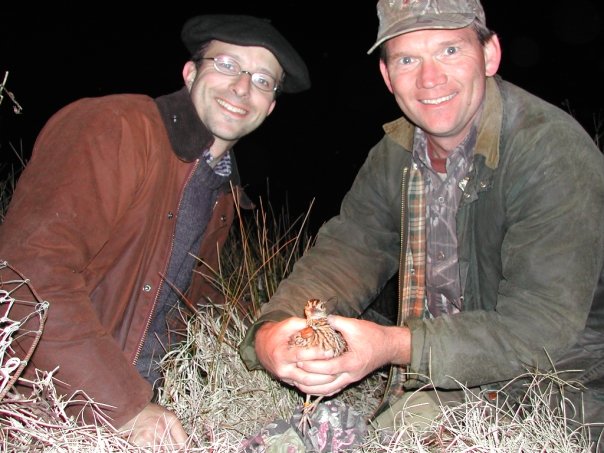
First Spotted tinamou (Nothura maculosa) ever radio tagged. Me with John Carroll
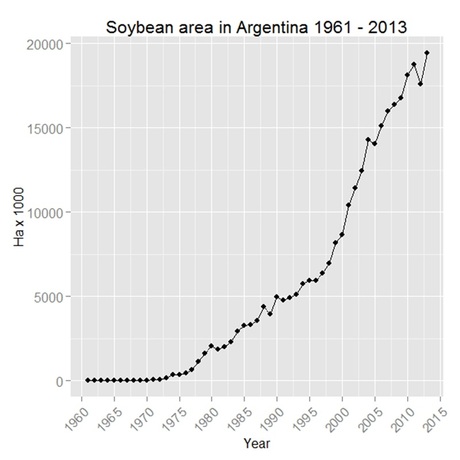
Harvested area of soybean in Argentina from 1961-2013 (FAOSTAT)
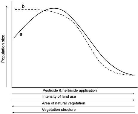
Graphical model of the effects of increasing agricultural intensification on grassland Galliformes (Thompson 2004).
|

|

|


|

|

|

|